Remote sensing: why are we interested in volunteered geographic data?
Colin Ferster (PhD Completed)
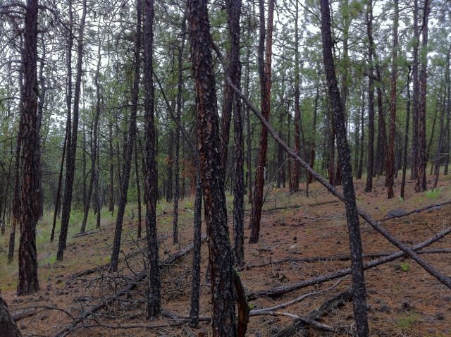 Remote sensing scientists typically use data collected by sensors on satellites and aircraft to find out about forested environments around the world. These unique views from above provide researchers with valuable information about forest health, forest growth, forest disturbances (such as fire and insect attacks), and many other important things. However, these airborne and spaceborne remote sensing devices have a limited ability to provide information about the parts of the forest that are close to the ground, or obscured by thick forest canopies. For example, fallen logs and understory vegetation are important parts of the forest for wildlife habitat, but it can be difficult to measure these with satellites. As a result, collecting these measurements must be done by people, which of course is more time consuming and costly. As a consequence, such measurements are usually very limited in terms of geographical extent.
Why smartphones?
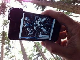
 Imagine if there was a way to quickly and easily collect measurements from the ground level, and use them in combination with the airborne and spaceborne remote sensing data. This would provide a more complete set of information about the world’s forests leading to a better understanding of how our environments work. This research is grounded in the fact that, recently, more and more people have access to smartphones. Smartphones provide the ability to quickly and easily make measurements of the forest using the principles of remote sensing, and share the measurements over the internet. Specifically, smartphones are commonly equipped with a camera, global positioning system (GPS), touchscreen (for entering observations), and the ability to store data and transfer data over a network.
How does wildfire play into this?
 Every year in Canada, individuals and communities are threatened by hazardous wildfires and preventative measures are needed to keep people safe who live in surroundings where wildfire occurs. Forest fuels management is the identification of parts of the forest where there is fuel available to burn, and reducing the amount of fuel before there is a wildfire risk. Effective forest fuels treatments require understanding and cooperation between a range of stakeholders, including provincial and municipal governments, private property owners, and members of the community at large.
The Forest Fuels App
 One of the first mobile remote sensing applications, developed by the Integrated Remote Sensing Studio at UBC and Vallhalla Consulting in Coldstream, BC, is meant to measure the amount of fuels available for wildfires in a forest. It is an experimental smartphone application which captures GPS coordinates, measures site conditions, and records imagery. We are interested in testing this application with a range of people from the community to assess methods of collecting measurements and ensuring data quality – as well as ensuring that the app is both useful and practical for everyone who uses it. Our main goals are not only to use technology to develop approaches that provide informative data about forests, but also a meaningful way for a range of people to be involved in scientific research and forest management in their communities.