Cameron Cosgrove
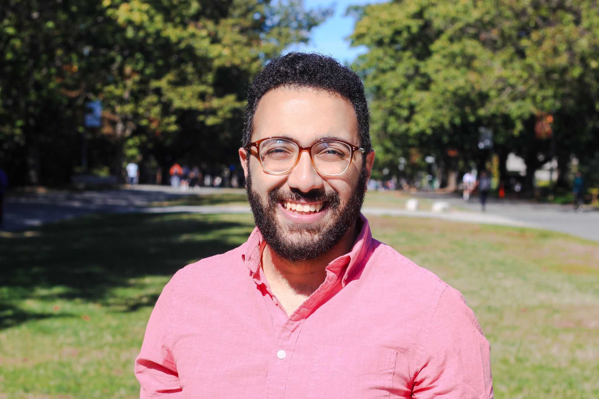
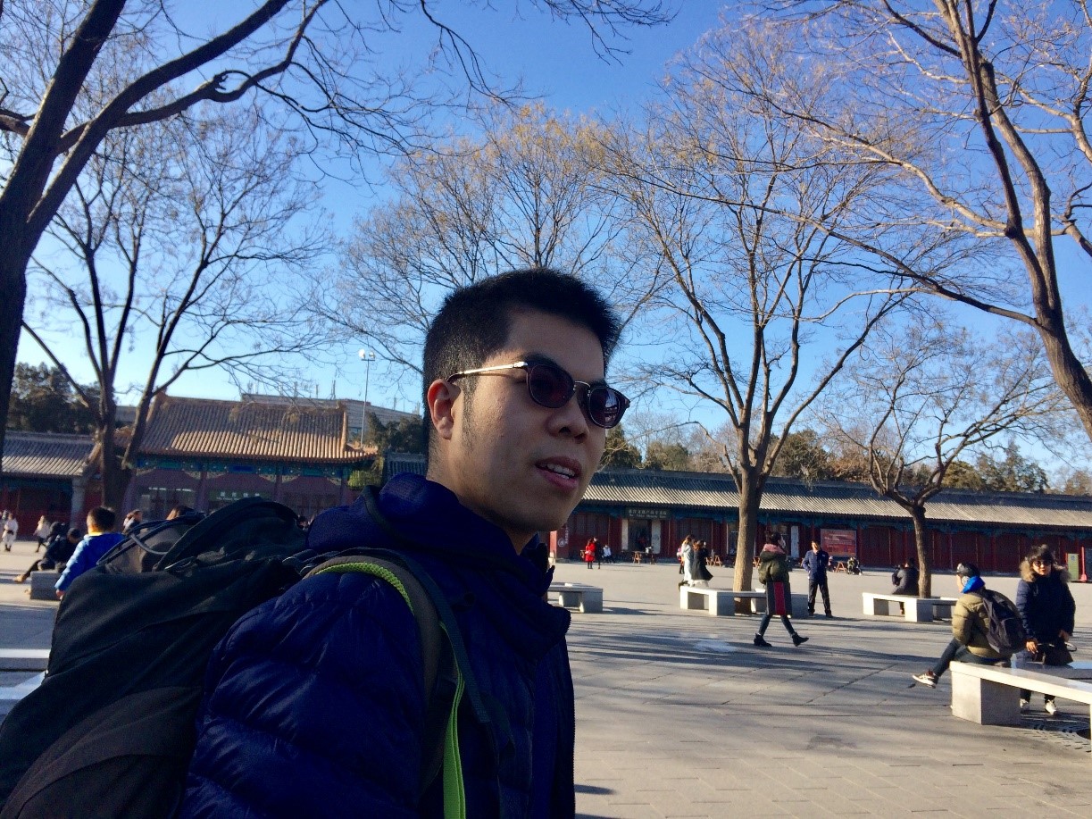
 Cameron Cosgrove is an ecologist who joined the Integrated Remote Sensing Studio in 2020 as an MSc student. He grew up in the village of Grantown-on-Spey, in the Highlands of Scotland and studied Ecological and Environmental Sciences at the University of Edinburgh. While on a student exchange at UBC in 2017, Cameron took one of Professor Coops’ classes and got hooked on remote sensing. Cameron’s research interests are focused around conservation and land management and how data (particularly from remote sensing) can be effectively incorporated into decision making.
Cameron’s research in the lab is exploring how we can use ALS data to map the nesting habitat of the marbled murrelet (an old growth nesting sea bird), with the goal of supporting forest management and the conservation of this species in British Columbia.
Prior to joining the lab Cameron worked with Forest and Land Scotland, developing best practice to reduce the impact of forestry on endangered species and most recently was a Woodland Mapping Intern for the Cairngorms National Park Authority. You can follow him on twitter at @CryptidCosgrove
Andrew Chadwick
Andrew Chadwick was born and raised in Toronto, where from an early age he found himself enamored with the city’s ravine systems. Forever fascinated with the intricacies of the natural world, it is no wonder that Andrew pursued a Bachelor of Environmental Studies. In recognizing the need to better harmonize human and non-human systems, he specialized in Environmental Management during his undergraduate degree, where he soon discovered the powerful tools of GIS and Remote Sensing. This led him to the Master of Geomatics for Environmental Management program at UBC, of which he is a recent graduate.
Now, Andrew is developing an operational tool that will leverage UAV-derived orthographic imagery and photogrammetric point clouds to deliver enhanced post-harvest regeneration inventory data. This project bridges the burgeoning fields of remote sensing, computer vision, and machine learning and as such, Andrew is very excited and thankful to be working on it as part of the IRSS.
Tristan Goodbody
 Tristan Goodbody was born in the wild, cow-wrangling city of Calgary, Alberta. He grew up an expat in Ecuador, Malaysia, and Scotland prior to his admission to the UBC Faculty of Forestry in 2010. His involvement in the co-op program there afforded him hands-on experience working in the forest industry with West Fraser Timber Ltd. in Chetwynd, BC, and in research based forestry operations with the Alex Fraser Research Forest in Williams Lake, BC. Tristan graduated with a BSc in Natural Resources Conservation in 2015 and decided that he was not yet prepared for the real world.
Tristan’s research with the IRSS will use drone-captured imagery and semi-global matching to predict residual timber volumes following selective harvesting, to gauge stand regeneration success, and to map the extent and perimeter of local fires in the Alex Fraser Research Forest. In his spare time, Tristan can be found with his dog, Kyra, or anywhere there is good food.
Paul Hacker
 Paul is a Potdoctoral Research fellow using deep learning algorithms to predict forest growth from point clouds data. His academic background includes a BSc in Natural Resource Conservation and a Master of Geomatics for Environmental Management (MGEM), both completed in UBC’s Faculty of Forestry. Paul finished his PhD in September 2022, which explored the applicability of leaf- and drone-based spectroscopy to evaluate functional trait variation in Garry oak ecosystems on B.C.’s south-west coast.
When not at work Paul enjoys spending time with his two daughters, as well as skiing and fishing. Paul hopes that his work in conservation science will lead to a stable future for his family and provide useful information for land managers looking to promote resilience and stability.
Spencer Dakin Kuiper
spencer.dakin.kuiper@hotmail.ca
 Spencer Dakin Kuiper grew up in Lethbridge, Alberta, and obtained his Bachelor’s degree in geography and a certificate in GIS & remote sensing from York University in Toronto, Ontario. As an undergraduate student, Spencer played varsity volleyball and was lucky enough to attend a field course along Iceland’s southern coast. Before starting at UBC Spencer worked as a cave guide on Vancouver Island, in human wildlife conflict at Waterton Lakes National Park, and a technician in the parks planning department at Credit Valley Conservation Authority in Mississauga, Ontario.
Spencer’s research with IRSS focuses on the application of ALS data to the mapping and characterization of stream networks and riparian vegetation metrics that are important to fish habitats.
When not in the lab you can find Spencer enjoying the outdoors, and playing volleyball at Kitsilano beach trying to relive his glory days.
Mohamed Elhefnawy
s-mohamed.elhefnawy@zewailcity.edu.eg
 Mohamed Elhefnawy was born and raised in Cairo, Egypt. After receiving his BSc in Communication & Information Engineering, he moved to Montreal in 2018 to pursue his Ph.D. in Mathematics & Industrial Engineering at Polytechnique Montreal. His main research interests are AI, Machine Learning, Deep Learning (DL), IoT, Operations Research, Decision Sciences & Statistics. As an interdisciplinary approach, Mohamed is interested in applying AI in different applications to maximally exploit the available data for better decision-making process. During his PhD, He worked as a research assistant for data integration & fusion at CanmetENERGY Varennes. In this internship, he has worked in strategic projects in the Federal Government of Canada such as Forest Value Chain Optimization (FVCO).
After getting his PhD degree in February 2022, Mohamed Joined IRSS as a postdoctoral fellow to apply DL on forest remote sensing data. In his free time, he enjoys watching soccer games and playing table tennis.
Alex Bastyr
 Alex was born and raised in Toronto. As a holder of three passports, he enjoys traveling and experiencing different cultures. He spent two summers working as a lifeguard above the Arctic Circle in Nunavut and completed a semester abroad studying at the University of Edinburgh. In 2019, he graduated from McGill University with a major in Earth and Planetary Sciences. At McGill he had the opportunity to complete field courses in the Mojave Desert, the Massif Central region in France and travel to Kenya and Tanzania. His field studies piqued his interest in geospatial and data analysis and led him to the University of British Columbia’s MGEM program. After completing the MGEM program in May 2021, he continued his UBC experience by joining the IRSS as a research scientist where he is working on tree species prediction using Landsat / NTEMS datasets. After surviving seven years of competitive swimming, physical fitness remains high on his priority list. At present, he enjoys hiking, skiing, paddle boarding and yoga.
Michael Burnett
 Michael, originally from Ontario, got his Bachelor of Environmental Studies at the University of Waterloo before spending a few years travelling and teaching English. While abroad, he got interested in spatial analysis and remote sensing, so he got his certificate in Applied Digital Geography and GIS from Ryerson University. Michael then returned to Ontario for his MSc in Geography at Queens University where he researched the effects that urban heat islands have upon rural vegetated land covers. He is now a research scientist working on the Silva 21 project as an analyst. On his free time, Michael like to bike, hike, play music, and explore.
Ilythia Morley
 Ilythia is a geospatial scientist who joined the IRSS team in 2021 as a research assistant following the completion of her graduate degree at UBC’s Okanagan campus. Originally from Scotland, she grew up near Aberdeen and completed her undergraduate degree in Environmental Science at Glasgow Caledonian University. Following her undergraduate degree, Ilythia worked in Chengdu, China, on a wetland mapping project, after which she moved to Daejeon, South Korea, to work as a researcher at the Korea Institute of Energy Technology. In 2019 Ilythia moved to Canada to complete her graduate degree. Ilythia’s graduate research focused on terrestrial ecosystem change and the effects of change on large mammal landscape connectivity in the Chilcotin region of British Columbia. In the lab, she is assisting on a project developing new automatized approaches to accurately locate forest roads across Ontario from SPL data. Outside of the office, Ilythia spends her time hiking and camping in the summer and snowboarding in the winter.
Yangqian (Frederick) Qi
Yangqian (Frederick) was born and raised in Ningbo, a coastal city in East China. He spent two years studying ecology in China and transferred to UBC in 2017 to major in Natural Resources Conservation (Global Perspectives). Over the course of his degree, he worked as a research assistant in the Chinese Academy of Sciences to analyze the chronological changes of soil nutrients in forests and paddy fields. He also went to the University of Cambridge in the UK as an exchange student to examine the impacts of meteorological droughts on vegetation across diverse ecosystems using satellite-based solar-induced chlorophyll fluorescence.
After assisting different projects in IRSS as a Work Learn student, Yangqian was impressed by the power of remote sensing technologies and decided to pursue a master’s degree. His graduate research investigates the use of quantitative structure models based on UAV and terrestrial LiDAR in monitoring the forest inventory. Yangqian is looking forward to exploring the applications of remote sensing in different scenarios. During his spare time, Yangqian enjoys hiking, jogging, and travelling.
Thomas Miraglio
 Thomas grew up in Saint-Raphaël, on the Mediterranean coast in France. He is fond of snorkeling and scuba diving, but also appreciates the mountains through hiking and trail running.
He obtained his first Masters degree from ENSTA Paris, with a Major in Offshore Energies Engineering. Afterwards, he worked one year as a certification engineer for the offshore Oil & Gas industry, before deciding to completely change his field of work. He then underwent a second Masters degree at the university of Paris VII, with a major in Remote Sensing. He did his PhD at ONERA in Toulouse, focusing on the estimation of vegetation traits of Mediterranean canopies using imaging spectroscopy.
He is now a postdoc fellow at the IRSS, and his work will focus on processing the entire Hyperion archive over Canada to obtain Canada-wide plant functional traits estimations.
Martin Queinnec
 Martin grew up in the French Alps, spending most of his time hiking and skiing in the mountains. His desire to learn more about the environment lead him to study Environmental Sciences and Engineering at the Ecole Polytechnique Fédérale de Lausanne (EPFL, Switzerland), where he received a BSc and MSc.
Martin is currently a PhD candidate in the IRSS and his research focuses on enhancing the characterization of forest structure and resources for forest inventory and monitoring using airborne and spaceborne single photon LiDAR.
Federico Lingua
 Federico is a PhD candidate and his research explores the opportunities that arise from the use of big data in the valuation of forest non-market ecosystem services. Originally from Buriasco, a small village on the Italian Alps foothills, Federico studied forestry and environmental science within the University of Turin (Italy) where he received his master’s degree, later becoming a research assistant. Federico hopes that his work could contribute to a forest management able to take in account the entire array of ecosystem services that forests provide to humans. Outside the lab Federico enjoys swimming and admiring with his daughter the tireless movement of the columns of ants in the grass.
Jeremy Arkin
Jeremy Arkin grew up in the suburbs outside of Chicago before moving to Boulder, Colorado where he received a bachelor’s degree in EBIO (Evolutionary Biology and Ecology) and Geography. Aside from normal coursework, his first professional experience in forestry was the completion of his honours thesis under the supervision of Dr. Thomas Veblen where he analyzed the upper montane tree regeneration following the 2002 Hayman Fire. After graduation he worked as a Forestry and GIS Technician for Boulder County Parks & Open Space as well Colorado Parks & Wildlife where he was able to gain insight on how to properly manage land in accordance with the very best methods and research available. These experiences helped him to explore what kind of research he wanted to complete in graduate school as well as what kind of career he wanted to pursue afterwards, both of which he hopes will facilitate the coalescence of sound science and land management. His research with the IRSS allows him to explore and develop methods that use drones to assist in fire behaviour modelling and post-fire forest management.
Brianne Boufford
brianne.boufford@alumni.ubc.ca
 Brianne is originally from Surrey, British Columbia, and when she was younger, spent a lot of her time camping and exploring along the coast of British Columbia and the United States with her family. This has instilled in her a passion for the outdoors and an interest in knowing how the world works and has come to be. It is for this reason that she is pursuing a Bachelors of Science, majoring in Physics, here at the University of British Columbia. Throughout various courses and co-op terms during her degree, Brianne has come to realize that her passion lies in using mathematical and computational approaches for applications in environmental studies and forestry. This led her to the Integrated Remote Sensing Studio.
She joined the IRSS as a Work Learn student in May 2021 with an interest in learning more about remote sensing, geospatial analysis, and the forest sciences. Brianne is currently working on a project that involves analyzing snow dynamics within the boundaries of provincial parks in British Columbia, and using inter-annual trends over the last few decades to see how this has impacted local winter activities, such as skiing and snowboarding.
In her spare time, Brianne loves to ski, hike, camp, and run. She is a coffee fanatic and also enjoys reading a good book.
Leonard Buechner
 Leonard grew up in a small village in the Black Forest in southern Germany. He earned his bachelor’s degree in aerospace engineering from the University of Stuttgart in 2020 and then continued on to pursue a consecutive master’s degree. After taking some courses in pattern recognition and machine learning, his interest in remote sensing grew. Thus, he joined IRSS as visiting international research student in March 2022. During this time, he will work on quantifying the impact of mountain pine beetle infestation on wildfire fuel in Alberta, combining airborne surveys with species information and ALS data. He will continue at the IRSS in order to write his master’s thesis. His research will focus on using neural networks and image segmentation in forestry to move towards a more sustainable future.
When not working in the lab, Leonard spends his time in the mountains skiing, climbing, hiking, or whatever the outdoor season offers, and then preparing a well-deserved treat.
Levi Keay
 Levi is a Vancouver local who spent many of his days growing up skiing on the North Shore. His passion for the outdoors and a curiosity for how our species interfaces with the environment drew him to the Faculty of Forestry at the University of British Columbia, where he started his undergraduate degree in the Forest Sciences program. He would later pivot to the school’s Faculty of Science where he pursues a Major in Physics.
Levi got his first real taste of remote sensing as a summer Worklearn student for the IRSS. Excited by the opportunity to merge his passions for forested environments and technology, Levi stayed on as a Research Assistant after the summer was over in order to continue his research using optical imaging CubeSat-constellation data to detect forest disturbances.
Outside of school and work, Levi can often be found outdoors riding his bike. He enjoys competing as a part of the UBC men’s Ultimate Team and coaching young athletes in the sport of alpine skiing. His other interests include woodworking, speaker design and acoustics, and playing and listening to music.
Chloe Kinerson
 Chloe is originally from Nevada in the United States, where she grew up hiking and camping across Nevada and California. Her passion for the natural world, especially for the Sierra Nevada forests near her home, led her to study in the Faculty of Forestry at the University of British Columbia. She is currently in the third year of her undergraduate degree in Natural Resources Conservation with a focus on Science and Management. She started working for the IRSS lab as a Worklearn student in Fall 2021, where she provides assistance to a variety of research.
When not in school or the lab, Chloe enjoys roller-skating, disc golfing, and playing board games.
Chris Colton
 Chris Colton was born and raised in Pickering, Ontario and moved to Vancouver in 2014 to pursue a BSc. in Natural Resource Conservation at UBC. He is a master’s student in the IRSS and WildCo lab, where his research focuses on how forest harvesting affects grizzly bears in their North American range. He is finishing up a literature review summarizing grizzly bear habitat use in response to forestry and currently working with an established camera trap grid in and around the South Chilcotin Mountains Provincial Park to evaluate how ongoing and historical forest harvesting is affecting grizzly bear habitat use. He is particularly interested in how satellite based remote sensing can quantify forest harvest and how it can be applied to wildlife management. In his spare time you will usually find him snowboarding, otherwise he’ll be playing or watching basketball.
Lukas Jarron
 Lukas was born and raised in Ajax Ontario, a suburb just outside of Toronto. He grew up playing hockey and baseball and remains a faithful Toronto Maple Leaf and Blue Jays Fan. He spent summers during high school with family on Haida Gwaii and eventually got sick of the Ontario winters and permanently moved to BC to attend UBC. Lukas completed his M.Sc within the IRSS and is now a researcher using remote sensing methods to characterize industrial forestry. Lukas was also a distance runner for the UBC track team. He enjoys running, hiking and doughnuts in his free time.
Chen Shang
Chen Shang grew up in Beijing, China. When he was 18, he moved to Central China for his undergraduate degree in GIS and cartography at Wuhan University. Two years later, he started his journey in Canada through a joint program with University of Waterloo in Ontario, where he earned his second undergraduate degree in geomatics. Deeply impressed with the power of remote sensing, he stayed at Waterloo for his masters, working on a land cover change project using high spatial resolution imagery. Realizing the limitation of optical data, Chen moved to Kingston, Ontario, for his PhD at Queen’s University, where he got his hands dirty with LiDAR data for forestry applications.
Now as a Postdoctoral Fellow with IRSS, he is applying what he learned over the past years to Canada-wide land cover mapping with long time series of image composites. When Chen is not working in front of a computer, he enjoys reading, longboarding and the occasional flute playing.
Saverio Francini
 Saverio Francini was born in Tuscany, in a city set in the countryside between Siena and Florence. He has a Bachelor’s Degree in Natural and Environmental Sciences and a Master’s Degree in Forest Systems Sciences and Technologies with honors. He is a PhD student currently working on artificial intelligence remote sensing applications to automatically detect forest disturbances. His interests are programming, modelling, machine/deep learning and image processing in general. He has played piano since he was a child. He likes the sea, playing chess, eating well and drinking wine with friends.
Sam Herniman
Website: https://sam.rbind.io/
 Sam grew up between the countries of England and Northern California. He graduated from Bangor University with a degree in applied ecology in 2016. After graduating, Sam spent a short time researching dragonflies in Ugandan caldera lakes before starting a forestry internship in eastern Oregon for the US Bureau of Land Management and the Chicago Botanic Garden. At the IRSS, Sam explored how airborne laser scanning and multispectral time series can predict the occurrence of birds in boreal forests. Sam continues to live in Vancouver and works for a geological consulting company.
Bethany Arndt
Growing up in an outdoorsy family in the outdoorsy little city of Nelson, BC, Bethany had little choice but to fall in love with lakes, rivers, mountains, and forests. She loves exploring and discovering more about the intricacies and beauty of the natural world, which she considers God’s Masterpiece. She decided that a career in wildlife/conservation sounded like a good excuse to spend more time in and learning about nature, and has so far enjoyed her summers working in environmental consulting. After graduating high school Bethany moved to the Big City of Kelowna, BC, where she completed her undergraduate degree in Biology. Now she is excited to up the ante again with her graduate studies at the IRSS lab where she will be building models of grizzly bear response to roads. She’s a bit wary of all the people and a campus six times the population of her home town, but locals encourage her that there are many places to escape. Bethany looks forward to spending her time growing to love Vancouver by experiencing the hiking, biking, kayaking, and maybe even some culture. When she needs to hole up and introvert for a while Bethany enjoys reading, walks in the woods, and singing while she pretends to play guitar.
Brandon Prehn
Brandon is originally from California but he moved to Texas as soon as he could. Raised in Dallas, he graduated secondary school in 2008 and started school at Texas A&M University. He joined the US Army after 3 semesters, serving as a light infantryman with the 10th Mountain Division in Fort Drum, New York. From 2011-2012 he deployed to Kandahar, Afghanistan in support of NATO International Security Assistance Forces. After leaving the Army, he returned to Texas A&M where he graduated with a double major in Spatial Sciences and Forestry. After an internship analyzing satellite imagery with NASA’s Goddard Space Flight Center, his interests in remote sensing and geospatial technologies were confirmed, leading him to the IRSS at UBC.
Brandon enjoys international travel with his wife Christina, but on a typical night you’ll find him doing some online gaming. His research at the IRSS will use LiDAR to analyze the impacts of changes in forest structure on grizzly bear movement and survival.
Max Yancho
Max is the son a forester, raised under the towering sand cliffs and the dense hardwood forests of Northern Michigan. He graduated from Michigan State University in the Summer of 2013 with a B.S. in Forestry, concentrating in Forest Conservation and Environmental Studies. While at MSU, Max participated in research projects including the development of genetically modified poplar for biofuels, firewood sterilization, and commercial Christmas tree production. After graduation, Max worked in Northern Lower Michigan as a district forester, as well as a professional consulting forester, assisting private landowners in the scientific and ethical management of their forests. Max maintains the credentials of Candidate Certified Forester with the Society of American Foresters. Attending graduate school has been a long-time goal of Max’s, with his motivation to join the IRSS Lab stemming from his experiences in the forest products industry. Max is currently pursuing his M.Sc. degree. He is working with a local Vancouver remote sensing start-up to develop innovative UAV applications for forest management. Max is an avid outdoorsman, enjoying camping, hiking, fishing, and good beer.
Felix Poulin

Félix Poulin grew up in the beautiful Quebec City, spending his time in the forest or in the water. He loves hiking, road biking, surfing, when the water come closer, and travelling. He always wanted to work with natural resources and found a way to do it through the Forest management and environmental science program in Laval University, in Quebec City. During those four years, he has learned how to manage a forest and how to use forest management in a proper way.
That undergraduate program helped him develop an interest in remote sensing, more precisely with LiDAR technologies and how you can use it in forestry. During an internship in Alexis Achim’s lab in 2017 and in Nicholas Coops’ lab in 2018, he continued to develop this interest and since May 2019, he work as a MSc candidate in the IRSS lab to mix his two interests: forests and LiDAR.
Nick Leach
Nick Leach is a dyed-in-the-wool Pacific Northwest local. Born and raised in the Seattle area, Nick originally came to Vancouver in 2011 for his BSc in Physics and Astronomy, where he studied planetary astrophysics. After dabbling in different jobs– including working at a particle accelerator and a private medical devices lab– he eventually fell in love with satellite remote sensing and image processing. His research at IRSS will explore possibilities for using high-resolution commercial satellite data to quickly identify and understand forest disturbances.
Outside of the lab, Nick is a trail and ultrarunning junkie. He’s always looking for new ways to play outdoors, whether it’s running, climbing, scrambling, surfing, or just crawling into his trusty sleeping bag. He has also been known to pluck a tune on the banjo and has a lot of opinions about board games.
Shangrong Lin
 Shangrong Lin grew up in Guangzhou, a major city in Southern China known for its Cantonese culture. He obtained a BSc in geographical information system in South China Normal University, and then he moved to Beijing, the capital of China, to pursue his Master’s and PhD in the Institute of Remote sensing and digital earth, Chinese Academy of Sciences. After spending three years on his PhD in Beijing, Shangrong moved to UBC to work on a one-year research project at IRSS. His research at IRSS will explore the relationship between tower-based reflectance and canopy photosynthesis, which expands on the work of his idol, Thomas Hilker. Now his research interest is using ground-based instruments, such as radiometer, to understand the dynamics of carbon flux in forest ecosystems and developing new methods to estimate large-scale gross primary productivity with satellite data.
During his spare time, Shangrong loves swimming, hiking, and playing soccer. He enjoys travelling and wants to experience a different lifestyle in Canada.
Cam McClelland
Cam grew up just outside of small town Hinton, Alberta. Having spent most of his young life exploring the backcountry of the Wilmore Wilderness Park on horse back he knew he wanted to pursue a career in wildlife research and conservation. After completing his BSc in Environmental Earth Sciences at the University of Alberta he was able to realize this goal with the fRI Research Grizzly Bear Program. Cam spent four summers and a one year internship with the program working on projects ranging from population dynamics to predation. When not working with the fRI Cam split his time between travelling and ski bumming.
Wishing to expand his knowledge base, Cam will be working with the IRSS lab as an MSc candidate. He will be assessing how habitat availability influences space-time patterns of movement and survival of grizzly bears at fine spatial and temporal scales as well as differentiating movement patterns associated with different levels of landscape connectivity.
Alex Graham
 Alex is originally from North Vancouver and was a part of the UBC Baseball program during his undergraduate degree and completed his MSc in the IRSS between 2017 and 2019. His research explored the potential for drone-based photogrammetric surveys of disturbed conifer forests for terrain modeling and timber inventory purposes. Prior to that, Alex was a work-learn student in the IRSS while completing a BA in Geography.
Since 2019, Alex has been a GIS Analyst at BGC Engineering where he focuses on mass-processing of LiDAR change detection, photogrammetry and InSAR data for geotechnical hazard identification.
Alex now lives in Coquitlam, BC with his wife and two kids. Besides spending time with family, his hobbies include mountain biking and skiing.
Lukas Schreiber
 Lukas grew up in a village in Austria, not far from Vienna. He occasionally helped his father with managing the family forest. He spent countless hours walking through the woods, marking trees, planting trees, erecting fences and crunching numbers for the tax office. During this time he first came into contact with remote sensing when he used aerial photographs to delineate land use maps in order for his father to receive Common Agricultural Policy subsidies. He attended mechanical engineering school for five years and then served his country as an ambulance technician for nine months. After that he left for the Netherlands to pursue a BSc in Aerospace Engineering. During this he spent a semester doing a minor in forestry at UBC. It was there that he re-discovered his passion for forestry and as the Netherlands were way too flat for a mountain boy like him anyways, he decided to return and join the IRSS.
During his master’s he will look into biomass quantification, change detection, camouflaged vehicle detection and/or species identification using multispectral optical and synthetic aperture radar images from Urthecast’s satellites. In his free time, Lukas spends as much time as possible in the North Shore Mountains with the Varsity Outdoor Club. He especially likes ski touring and hiking but he is open to try many new things.
Anne Hervieux
Ann ie is a recent graduate of the Masters of Geomatics for Environmental Management Program at UBC, and before that she graduated from the University of Alberta (in her home town of Edmonton) with bachelor degrees in Ecology and Animal Biology. Annie has spent the last few summers working in Alberta as a Wildlife Biologist primarily conducting bird surveys and nest sweeps for industry. Over the winters she has worked as a Wildlife Management Technician mediating wildlife human conflict at the Vancouver Airport. In her free time, Annie likes to ski, hike and generally be outside… or in a coffee shop!
Annie started in the IRSS because she wished to build on the knowledge she gained through her masters studies, and feels that there is potential for geospatial analysis to play a role in understanding conservation ecology issues, hopefully reducing the human impact on wild spaces. As a research assistant, Annie will be using Digital Aerial Photogrammetry to assess forest regeneration and will link this with the regeneration survey practices currently employed in Alberta.
Lennart Noordermeer
Lennart Noordermeer was born in the Netherlands, and has grown up in several countries: Denmark (from age 1-4), the Netherlands (4-8), Indonesia (8-12), Malaysia (12-16), and the Netherlands again (16-18). After finishing high school, he travelled around Australia for a year working in timber mills, apple orchards and vineyards. He carried out a four-year bachelor’s degree in Forestry and Nature Management at the University of Applied Sciences in Wageningen, the Netherlands. He fulfilled the last two years of the program as a visiting student in Norway, where he enjoyed spending his free time in the outdoors.
After his bachelor’s, Lennart worked as a forest machine operator for four years, operating a cut-to-length thinning harvester in Østerdalen, Norway. He then decided to move to Ås, Norway, to get his master’s degree in Forestry at the Norwegian University of Life Sciences, where he continued with a PhD fellowship in forest inventory. He is now two years into his PhD on site productivity classification of forests using multi-temporal data from airborne laser scanning and aerial photogrammetry. As a visitor at the IRSS, Lennart will be testing an age-independent method for site index determination using a time series of point cloud data.
Joseph Rakofsky
 Joe was born in the Franglais-speaking city of Montreal, QC. Running to the window to watch lightning storms from his room, he was certain from the age of 10 that he would become a weather forecaster. Demoralized by the physics requirements for atmospheric science, he instead decided to pursue his life-long fascination with maps. In 2015, Joe earned his BSc in Environment from McGill University. In his last year and subsequent gap year, he carried out research with Professor Jeffrey Cardille using Landsat 8 to estimate concentrations of coloured dissolved organic matter (CDOM) in lakes of the Abitibi region of Quebec. He also used the optical data to categorize the area’s lakes in order to improve CDOM estimations from Landsat 5 and 7. Ultimately, inspired by the grandeur and aesthetic beauty of trees, Joe sought a project that would combine forestry and cartography. And so, Joe found his way to the IRSS lab to pursue his master’s. As a team member of AWARE, his research assesses the utility of LiDAR for the measurement of tree height-growth near Slave Lake, AB.
Zoltan Mityok
Zoltan Mityok’s life thus far can be summed up with one word: adaptation! Born in Calgary, AB and raised in a Hungarian household, his misadventures include growing up periodically in Europe, teaching English in Honduras, obtaining a B.Sc. in Natural Resources Conservation at UBC, and taking every opportunity to work through co-op internships in Wyoming, USA, interior BC and the Discovery Islands. Diverse work experiences called for as much adaptation as traveling: forestry engineering and reconnaissance, GIS mapping of the USDA’s Medicine Bow-Routt National Forest, and helping to establish a newly licensed community forest via ecological assessments, mapping, and liaising with community and board members.
From these varied cultural and professional experiences, Zoltan has adapted and incorporated a medley of ideologies, values and beliefs into his work and sense of purpose. Life has helped to distil his broad interests into GIS and remote sensing; the application of such technologies to answering questions about our world and the biotic-abiotic interactions influencing humanity’s decisions and quality of life. Zoltan is thrilled to begin adapting to his new life as an MSc candidate, and will be modelling snow dynamics and its influence on wildlife behavior within the St’át’imc territory using sensor, field, and radio-telemetry data.
Ethan Berman

Ethan Berman’s upbringing between New Delhi, India and Cambridge, Massachusetts has led to his split personality as an adventurous vagabond and inquisitive academic. After graduating from the University of Virginia in 2012 with a BA in Mathematics, he spent the better part of four years as a Princeton in Asia Fellow working with local communities in Thailand. He has worn many hats, including being a math teacher, IT technician, and experiential and environmental educator. Ethan’s first-hand exposure to environmental challenges in Southeast Asia and fascination with maps as a tool for sustainable management fueled him back across the Pacific to pursue an MSc as part of the IRSS. A little bit tired of the tropics, his research is focused on the complexities of mapping snow in forested and mountain environments and the effect of different snow variables on threatened wildlife populations.
You’re equally likely to find him plugging away in the lab as you are to find him slogging up to a cold mountain summit.
Txomin Hermosilla
txomin.hermosilla@canada.ca
 Txomin was born and raised in the medieval town of Portugalete, close to Bilbao, Spain. He studied Technical Engineering in Land Surveying at the University of the Basque Country (2002), Engineering in Geodesy and Cartography at the Polytechnic University of Valencia (2005), and obtained his MSc in Geographical Information Management at the Cranfield University (UK) in 2005. Afterwards, he moved back to the Polytechnic University of Valencia, earning his PhD in Cartography and Remote Sensing in 2011. Txomin first came to IRSS as a visiting Postdoctoral Fellow for six months between December 2012 and May 2013. Enjoying the experience and the people, he decided to return for further collaboration. His current project develops advanced methods for mass Landsat data processing for mapping and monitoring Canada’s forested ecosystems. In 2018 Txomin left his beloved IRSS to join the Canadian Forest Service as a Research Scientist, where he is currently continuing his research on integrating multiple-source remote-sensing data for forest ecosystem monitoring.
Txomin enjoys biking, gaming, and collecting unnecessary stuff such as PEZ dispensers, globes, starships, and stormtroopers.
Yuhao (Bean) Lu
yuhao.lu.ubc@gmail.com – howhaveyoubean.com
Yuhao (Bean) Lu was born and raised in Wuxi in China. He received a B.Sc in Forest Resources Management at the University of British Columbia and a B.Sc in Forestry at Nanjing Forestry University. Yuhao joined IRSS lab as a research assistant in 2013, working on forest modelling specifically on Coastal Douglas fir and Chinese fir plantations.
Now as a PhD candidate at IRSS, he is detecting and analysing urban land use changes and urban green areas using Landsat imageries. Yuhao enjoys staying active, travelling and taking photos.
Ignacio San Miguel
Ignacio San Miguel was born and raised in Madrid, Spain. His passion for natural resources management led him to study a BSc in forestry at the Universidad Politécnica de Madrid. He then pursued his interests through a MSc in Forestry at the Universidad de Valladolid where he worked on the connectivity of brown bear habitat, here he realized the full potential of GIS and remote sensing. Ignacio then worked at the Joint Research Centre in Italy, where he used satellite image acquisition campaign for the Common Agricultural Policy check subsidies. This experience strengthened his resolution to continue working on remote sensing for natural environment assessments and management. His MSc research will be on wildfire patterns analysis using aerial and satellite images.
Paul Pickell
Paul was raised in the United States mid-west before landing at Puget Sound in Washington. In 2011, he graduated from the interdisciplinary Evergreen State College with a BAS in forest ecology. As a post-doctoral research fellow at IRSS, Paul is undertaking research of forest fires to better understand how the boreal forest landscape mosaic has evolved over time. Specifically, Paul works with aerially-derived forest inventory data and moderate scale satellite imageries to map forest fires and forest recovery. His work will provide tools and information necessary to re-create the historical boreal forest landscape as well as forecast future burning conditions.
Giona Matasci
 Giona was born in Locarno and grew up in the sunny Italian-speaking corner of Switzerland surrounded by beautiful mountains and lakes. At 19 he moved to the French part of the country to study Environmental Sciences at the University of Lausanne. He received the M.Sc. degree in 2009 with a thesis on the forecasting of snow avalanches.
Introduced to remote sensing, he decided to continue with a doctorate in this field, obtaining the Ph.D. degree in 2014. His research tackled the problem of the portability across images of land-cover classifiers and leveraged machine learning approaches to ease their adaptation.
After a year spent discovering Latin-America, he is now ready to start this new adventure here at IRSS. His post-doctorate focuses on the combination of LiDAR acquisitions and optical images through data-driven methods to study forest dynamics.
While in British Columbia, he is looking forward to explore and ski down as many powder-filled slopes as possible. Also, he is an avid hockey fan and passionate about travel photography.
Doug Bolton
Doug Bolton was born and raised on Cape Cod in Massachusetts. He received his bachelor’s degree in Environmental Science and his master’s degree in Remote Sensing and GIS from Boston University. Doug’s work at BU included predicting crop yields in the United States with MODIS data and mapping the spread of insect infestations through New England with Landsat time-series data. Following the completion of his master’s degree, he took off to the west coast to pursue his PhD at the University of British Columbia. Here at UBC, Doug’s work involves using a combination of LiDAR and optical remote sensing to better understand forest recovery following disturbances.
In addition to his work at UBC, Doug enjoys exploring British Columbia, snowboarding at Whistler, and learning (to love) the metric system.
Alison Beamish
Alison was born and raised in the east end of Toronto near the shores of Lake Ontario. Alison did her undergraduate studies in Kingston, Ontario at Queen’s University prior to moving to Vancouver to pursue a Masters degree in the Geography department in 2011. While at Queen’s and UBC Alison had the unique opportunity to travel twice to the Canadian high Arctic to participate in ecological field research on Melville Island in the Western Canadian Arctic Archipelago and Ellesmere Island at the eastern edge of the Canadian Arctic Archipelago. Alison began her academic career as a physical geographer/ecologist studying carbon cycling and botany in her undergrad and masters, respectively.
In 2015 Alison moved to Berlin, Germany to pursue a PhD in remote sensing at the Alfred Wegener Institute in Potsdam, Germany. Alison’s PhD research focuses on new applications of hyperspectral remote sensing data in Arctic ecosystems with a focus on vegetation phenology and change. She works closely with IRSS at UBC and partners at the University of Alaska, Fairbanks where she has conducted both laboratory and two Arctic field campaigns. In her spare time, she can usually be found in the mountains on her bike, skis, or mastering the German language.
David Williams
Born in Vancouver and raised in Victoria, Dave Williams spent most of his teen years and early twenties with designs on a music and writing career whilst dabbling in food service, social work, and tree planting. It was his experience with the latter and a growing awareness of impending global ecological doom that led him to the Natural Resources Conservation degree program in UBC Forestry, finding that his interests lie in urban socioecological systems, dynamics of ecosystem services, and political ecology.
As a member of both the IRSS and the Landscape Ecology Lab (LEL) under Sarah Gergel, Dave is working as an MSc candidate on using LiDAR and RapidEye multispectral data to produce a high resolution land cover map of Metro Vancouver. From this map, Dave aims to model the sources and flows of ecosystem services and compare them with socioeconomic data to see how urban form relates to ecological justice.
Adam Erickson
adam.michael.erickson@gmail.com
 Adam Erickson grew up in the temperate forests of the Puget Sound basin. He studied International Political Economy for his B.A and then worked in marketing while volunteering with The Nature Conservancy. Adam studied regional planning for his master’s degree, where he researched Pacific Northwest watershed management and salmon recovery planning. He then developed novel methods to visualise municipal land use in Oregon and to inform water quality monitoring efforts using GIS at a water quality laboratory in California. Adam’s research combines landscape-scale forest ecosystem modelling with remote sensing to simulate the long-term ecological effects of changing natural and anthropogenic processes on grizzly bear habitat in the foothills region of Alberta. Adam welcomes opportunities to collaborate. His ultimate goal is to help improve the social-ecological resilience of northwest North America.
Amanda Mathys
 Amanda Mathys was born in Vancouver, BC, and grew up in Zurich, Switzerland. Having spent most of her life surrounded by mountains, she enjoys outdoor activities such as skiing, hiking, and camping. After high school, Amanda returned to Canada to complete a B.Sc.H. in Environmental Science at Queen’s University. During this time she worked as a GIS/GPS Field Technician and as a CIDA Intern with UNESCO in Colombia. Amanda then moved back to her city of birth to complete a M.Sc. in Soil Science at UBC, where she investigated the effects of the mountain pine beetle and forest management on the forest carbon balance. Her interest in forestry led her to join IRSS and pursue a PhD. Her research will integrate remote sensing and public participation techniques to map forest species distribution in the Pacific Northwest.
Andrés Varhola
Andrés was born and raised in Quito, Ecuador, one of the most beautiful cities in the world where colonial architecture is surrounded by magnificent snow-capped mountains. In 1997, he started his undergraduate career as a Forest Engineer at Universidad Austral de Chile (Valdivia, Chile). After obtaining his degree in 2001, he was hired as the Silviculture Head for Aglomerados Cotopaxi —one of the most important forestry companies in Ecuador— where he held a wide range of responsibilities that included forest management, certification, fire protection, and research & development. After working there for five years, he decided to complete his education as a Forestry PhD Student at UBC. His research project focused on the application of remote sensing technologies to better characterize forest structure with the ultimate objective of improving hydrologic modelling. Andres continues to research and work at UBC as a sessional instructor in Geography and Forestry.
Andrew Plowright
Anna Yuill
annayuill@gmail.com
 Anna was born in AB but was raised in picturesque Kelowna, BC. Growing up she developed a spirit for the mountains and has pursued activities including rock climbing and mountaineering. With a passion for the outdoors, she became interested in learning about the environment. In 2014 she graduated with a BSc in Natural Resource Conservation at UBC. During her undergraduate degree, she participated in a co-op program, working in a variety of positions, including time as a Wildlife Biologist for Parks Canada and a Forest Engineer with Western Forest Products. She is fascinated by remote sensing, LiDAR in particular and hopes to pursue a MSc in analyzing LiDAR-derived data in forested ecosystem.
Aria Guo
Aria Guo was born and raised in Shijiazhuang, a city in the central north of China. She has embraced and appreciated the Canadian wildness through hiking, backpacking and many road trips since she arrived in Canada as a transfer student from China. Aria obtained her undergraduate degree in Forest Resources Management from UBC Forestry. Afterwards, she spent a short stint in the field as a timber cruiser, then started a career as a certified air photo interpreter, working in Ontario and Alberta mapping forest resources, land use changes for forest inventory and biodiversity monitoring projects.
Aria happily returned to UBC as a M.Sc. student in 2015 after she realized that remote sensing data were essential to provide ecological information and relevance effectively solving real-world problems. Her project is to develop forest-related biodiversity monitoring indicators and tools using LiDAR and other data sets to better our understanding of the linkage between forest structure, landscape connectivity and conservation of biodiversity.
Chris Bater
 Chris was born on the windswept grasslands of the Canadian Prairies sometime in the late seventies. After a youth wasted bussing tables by day and playing bass in shoddy bands by night, he studied physical geography at the University of Winnipeg. Indifferent to the fact that the Red River flood plain is the second flattest place on the planet, Chris specialized in geomorphology, eventually completing a thesis on the history of a small stream that no one has ever heard of. It was one of the happiest periods of his life.
Following the completion of his BAH in 2002, Chris spent eight months doing what the majority of people with geography degrees do: working in retail. He was then employed as a Quaternary geologist for the Manitoba Geological Survey, digging holes and trying to dream up interesting things to say about them.
Chris attended the Centre of Geographic Sciences for two years, where he completed advanced diplomas in GIS and geomatics. He then spent the summer of 2005 completing an internship at ESRI in Redlands, California.
Chris completed an M.Sc. in 2008 which involved researching the capacity of lidar remote sensing to assess indicators of forest sustainability. His study area was near Tofino, Vancouver Island. (Neither hippie nor surfer, he doesn’t understand why the powers-that-be decided he should be the one to spend his summers there, but he is grateful nonetheless.) Chris is currently involved on projects related to the mountain pine beetle outbreak, grizzly bear habitat mapping, and phonological monitoring. He is playing more bass than ever.
Colin Ferster
 Colin Ferster studied the use of mobile personal communication devices, such as smartphones, to collect and map ecological data. Mobile personal communication devices are becoming increasingly ubiquitous, creating a global network of sensors equipped with instruments capable of collecting ecological data, such as a camera, compass, and GPS. In many cases, mobile personal communication devices may compliment airborne or spaceborne remote sensing instruments, for example, by making measurements under dense forest canopies, with high temporal frequency, recording rare events, and engaging citizen scientists to help answer critical research questions about earth systems. Colin has completed his PhD.
Previously, Colin completed an MSc (honours) in the IRSS in forest carbon science, integrating GIS, LiDAR, optical remote sensing, and forest inventory methods. Colin competed a BSc (with distinction) at the University of Victoria. In addition, Colin has completed co-op workterms for the BC Ministry of Energy and Mines Resource Information Section and Canadian Forest Service, Pacific Forestry Centre.
Curtis Chance
 Born and raised in the Vancouver area, Curtis has always dreamt of becoming a Vancouver Canuck. Unfortunately, that dream was squashed when he didn’t make the rep hockey team in Grade 7. Since then, Curtis has been interested in owning a boat, as well as science of all sorts, and in 2014 he found himself graduating with a B.Sc. from UBC’s Faculty of Forestry. Immediately after, he started a job with a First Nation’s government in BC, producing land cover maps using remote sensing. In continuing his pursuit of knowledge (and a boat), Curtis’ master’s research explores the utility of hyperspectral imagery and LiDAR data to detect and map invasive species in urban forests.
Don Iwanicka
Don was born in Edmonton, Alberta, Canada and spent his childhood exploring the vast areas around the family farm south west of Edmonton. This was the beginning of his fascination of everything spatial. Don graduated from the University of Lethbridge in 2007 with a B.Sc. in Geography. It is in Lethbridge where his interest in and affinity for Remote Sensing and GIS took off. Some of his hobbies include reading and hockey. Don was a research assistant with the IRSS lab from May 2007 until March 2008.
Emily Shinzato
emilyshinzato@florestal.eng.br
Emily Shinzato was born and raised in Sao Paolo, Brazil. She obtained her forest engineering degree from the Federal University of Sao Carlos (UFSCar) in Brazil, and is currently an MSc student in Remote Sensing at Brazil’s National Institute for Space Research (INPE). Emily is participating of the Emerging Leader in the Americas Program (ELAP) program as a visiting researcher at UBC, where her task involved estimation of forest parameters with lidar and orthoimagery. She is especially interested in challenges emerging from plantation-style forest management.
Fabio Fontana
 Fabio studied geography and biology at the Universities of Bern (Switzerland) and Stockholm (Sweden) and completed his MSc degree in geography at the University of Bern in 2005. After a couple of months as a research assistant in the Remote Sensing Research Group, University of Bern, Fabio started his PhD studies in the same group, specializing on the analysis of AVHRR and MODIS data to study land surface parameters in mountain regions. During that time he also spent three months at the Canada Center for Remote Sensing in Ottawa, Canada.
Suffering from a “Post-PhD-exhaustion-Syndrome”, Fabio fled from real life after his PhD degree in October 2009 and travelled through South America for three months. After his return to Switzerland, he worked as a postdoctoral fellow at the University of Bern on the validation of a new cloud mask for the MSG SEVIRI sensor. Fabio then joined the IRSS lab as a postdoctoral fellow in July 2010. His work includes the analysis of AVHRR data over the Canadian land mass to derive long-term variations in habitat conditions to indirectly analyze changes in biodiversity… But most of all, he enjoys being outdoors in beautiful B.C… hiking… biking… camping…skiing…
Greg Rickbeil
grickbeil@gmail.com
 Greg Rickbeil grew up in the diverse metropolis of New Westminster, BC and was, of course, a Salmonbelly. After brief stints at SFU, UVIC and the circus, Greg finished a B.Sc. in Conservation at UBC. Greg’s MSc research focused on avian biogeography and diversity in British Columbia, integrating freely available RS data with large scale avian data sets to produce avian distribution estimates and inform conservation across the province. Greg’s PhD is focusing on slightly larger animals, tundra caribou, and how RS data can be used to test ecological questions regarding caribou – environment relationships and the effects of changing arctic ecosystems. Basically, if it involves animals and large scale patterns, it’ll be of interest to Greg. In his free time, Greg takes as much advantage of living in the lower mainland as possible by getting out of it, up the Sea to Sky for a bike or snowboard, or into the Kootenays for a beer.
Jean-Simon Michaud
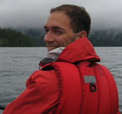 Jean-Simon Michaud was born in December 1984 and raised in a suburb just north of Montréal, Québec. City life was appealing, so he enrolled in a geomatics program at the Collège Ahuntsic in Montréal. After getting his degree, J-S worked for one year as a distribution service manager for Hydro Québec. Although he enjoyed his time with Hydro Québec, he quickly realized that he missed doing cartography and managing natural resources as part of his daily job. Thus, he moved on to pursue a Bachelor`s degree in Applied Environmental Geomatics at the Université de Sherbrooke, QC. During this time, he worked with Nature Conservancy Canada to develop an evaluation system to assess the value of aquatic ecosystems which would serve to guide conservation efforts in southern Québec.
Jean-Simon’s growing interest in conservation and wildlife management using remote sensing and GIS have lead him to pursue a M.Sc. at the University of British Columbia. He is now researching the relationship between the biomass or the foliage vigor (driven by remote sensing) and wildlife behavior.
Although he may not hold the title of youngest PhD student in the faculty of forestry, Jean-Simon is the youngest of his group and greatly appreciates the advise of his colleagues. During his spare time, Jean-Simon likes to go hiking, sailing, biking, kayaking, snowboarding and wind surfing.
John Arnett
 Born in Vancouver, BC John is a rare 5th generation Vancouverite. Growing up on rural Salt Spring Island he developed an intense interest and desire to learn about natural systems. In 2008, John joined the UBC Faculty of Forestry and graduated in 2012 with a B.Sc. in Natural Resources Conservation.
He has worked for a variety of institutions, including Parks Canada and The Salt Spring Island Conservancy. Prior to starting his MSc in the IRSS lab, John worked as a summer student creating a set of Landsat-derived cover change maps for the Nisga’a Lisims Government. John’s master’s research involves developing automated disturbance detection techniques using high resolution RapidEye Constellation data. When John is not in the lab, he is likely to be found riding his bike.
Lorraine Campbell
 Sixteen years ago, Lorraine moved from Tofield, AB, a small farm town outside Edmonton, to the BC coast and since then has held a number of positions in the outdoor industry, including ski patrol and kayak instructing. She knew that her interests in ecology would influence her career decisions, leading her to complete a BSc in Conservation here at UBC Forestry and find a position in the IRSS as a summer research assistant. This interest in ecology—and a lifelong love of maps, of course—made her decision to attend graduate studies in the IRSS an unexpected but easy one. Lorraine’s MSc will investigate how LiDAR can be used to advance and improve BC’s terrestrial ecosystem mapping process.
In her spare time Lorraine can almost certainly be found rock climbing, mountaineering, skiing, or otherwise enjoying the great British Columbian outdoors.
Martin van Leeuwen
Born in Holland, Martin was raised with the beauty of tulips, daffodils, and the sheer amount of colours that these flowers bring with them. Although he did like these little colourful gifts of nature, it may have been the rarity of seeing forests in his country that made him decide to pursue his career among trees. He started his undergraduate preparation at Wageningen University (The Netherlands) in Forest and Nature conservation. He soon realized the eminent value of remote sensing to forest science. Therefore, in 2005, Martin started his M.Sc. at Wageningen University in Geoinformation Science, where he developed a decent background in multi- and hyperspectral remote sensing. This study definitely boosted his enthusiasm. In fact, he liked it so much that he decided to have a look into LiDAR remote sensing as well at University College Dublin (Ireland). Gaining a second M.Sc., his ultimate goal was to combine all his knowledge in his Ph.D. research at the University of British Columbia to find improved means to determine light use efficiencies in Canada’s extensive forested ecosystems to support forest growth modelling.
Nicholas Goodwin
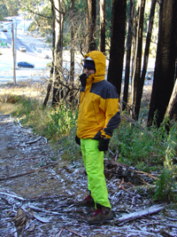
Prior to joining the IRSS lab as a post-doctoral fellow, Nick obtained a BSc and PhD from the University of NSW in Australia.
His research areas relate primarily to remote sensing of forested environments using airborne LiDAR and passive optical imagery. However, he is also an EPiCC (Environmental Prediction in Canadian Cities) project participant which involves the derivation of urban land cover attributes using LiDAR data.
Nick Soverel
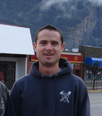
From Maine (the US), Nick developed a love for nature and the outdoors in this wooded state. His favourite thing to do was catching frogs and hiking. Not much has changed since then. He attended the University of Vermont and studied Natural Resources with a focus in Ecology. After college he worked on an ice cream truck and as a park biological technician. He worked at Big Thicket National Preserve in Southeast Texas, as a seasonal firefighter at Bryce Canyon National Park in Bryce, UT, as a resource assistant for the US Fish and Wildfire Service at the National Interagency Fire Center, and as a seasonal firefighter at Olympic National Park near Port Angeles, Washington state, United States. He has a strong interest in fire management and remote sensing. After working at the US national office in Boise, Idaho he became increasingly aware of the complexity involved in fire planning and fire ecology on a landscape scale. His masters involved using Landsat imagery to inventory burn severity in Canadian parks. This work involves using a fire effects monitoring system used in the United States called FIREMON. Canadian parks to date have not inventoried their fire burns to this extent and this data will help to explain the effects of fire on ecosystems in places like Wood Buffalo National Park in North-eastern Alberta.
Olivier Tsui
Olivier was born in Paris and immigrated to the beautiful and culturally diverse city of Montréal, Québec in the early 80’s. Raised in a family of culinary chefs and restauranteurs, Olivier at a young age developed a fondness for gastronomy and the culinary arts and is often seen eating. When not eating, Olivier managed to graduate from McGill University with a biology degree. Unsure what to do with his recent degree, he decided to take a plunge into the field of GIS and remote sensing and moved to Vancouver, B.C. to complete the Advanced GIS Diploma Program at the British Columbia Institute of Technology.
After graduating from BCIT, Olivier worked at MDA Geospatial Services, CH2M HILL, and Hatfield Consultants. Developing an increased interest in remote sensing, especially RADAR technology, Olivier decide to put aside his aspiration of opening is own culinary restaurant to further his knoweldge. Aside from always searching for the best noodle shop and hidden culinary gems, Olivier is currently pursuing a M.Sc. at the University of British Columbia. His current research project focuses on the application of polarimetric SAR and LiDAR integration to improve large area forest biomass estimates.
Rachel Gaulton
 Rachel completed her BSc in Ecology at the University of East Anglia (UK) in 2003, having developed a strong interest in forest ecology during an exchange year spent studying in the US (UMaine). After an obligatory year of temporary admin jobs, waitressing and a bit of travel (in Canada and Alaska), she returned to academia and began a PhD at the University of Edinburgh in 2004. Her research examined the use of high resolution airborne remote sensing for identifying canopy gaps in Sitka spruce plantations and describing and quantifying spatial heterogeneity of forest structure. During her PhD, Rachel took some time out to work on a fellowship at the Parliamentary Office of Science and Technology in London, further developing an ongoing interest in science communication and policy.
Even though she will greatly miss the impenetrable Scottish spruce plantations, Rachel jumped at the chance to spend time in Vancouver and joined the IRSS as a postdoctoral fellow in March 2009, leaving for more research in March 2010. Her research interests include spatial modelling of forest productivity using the 3PG forest growth model and more generally, ecological applications of remotely sensed data (especially lidar and hyperspectral imagery). When she escapes from work, Rachel enjoys being outdoors, whether hiking, attempting to windsurf or sitting in the sun with a beer.
Riccardo Tortini
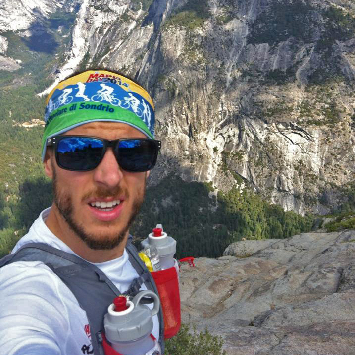 The first of two brothers, Riccardo was born and raised in rural Secugnago, Italy, in the heart of the Po Valley. He first encountered remote sensing while studying Urban, Environmental and Landscape Planning (2005) at Polytechnic University of Milan, Italy. This interest was furthered while studying engineering after having joined the Laboratory of Remote Sensing. His research activity within the lab focused on the effects of hydrocarbon seepage on sparse vegetation, a topic that he continued to study in the two years following his Masters in Environmental Engineering (2009). In 2011 he crossed the pond and landed in Michigan’s beautiful upper peninsula, where he obtained his PhD in Geological Engineering (2015) at Michigan Tech. There, his research covered the effects of sulfur dioxide deposition from volcanic passive degassing on vegetation types.
Initiated to soccer in his early years, Riccardo is now an avid outdoor enthusiast and endurance freak: he loves trail ultrarunning, long mountain bike rides, and cross country ski tours. When not on the trails training for his next marathon or dabbling with landscape photography, you can find him enjoying a beer or espresso at his favorite Vancouver spots.
Rory Tooke
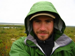 Rory was raised in rural Ontario on a small hobby farm with numerous barnyard beasts including horses, chickens, goats, rabbits, dogs, cats, and a donkey. Camping and canoeing were introduced to him at a young age, and many summers were spent in Ontario’s provincial parks. Rory’s enthusiasm for outdoor activities was a deciding factor in his relocation to Vancouver, BC, where he spent his summers on his bicycle and winters on his snowboard.
As an undergraduate student Rory had a taste of various courses from economics to philosophy until discovering his passion for Geography while attending the University of Otago in New Zealand. Between years of formal education, Rory took time to live and explore different societies and cultures in Canada and around the world. This mosaic of experience and education has inspired Rory to further investigate connections between place and people through his Masters degree where he studied relationships between physical land cover patterns and socio-economic variables in urban environments.
Ryan Frazier
farawayhillsaregreener@gmail.com
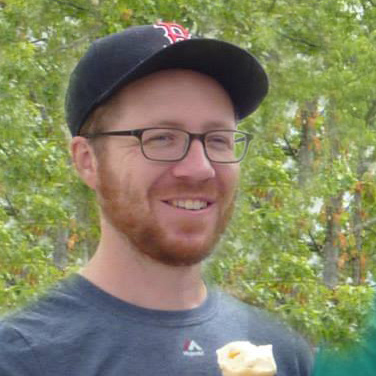 Hailing from Boston, Massachusetts, Ryan attended Clark University and received a BA in Geography and an MA in Geographic Information Science. During this time he worked in a large area mapping and monitoring program that mapped forest cover over Massachusetts using multiple years of Landsat data. It was there that Ryan developed an affinity for Landsat. After leaving Clark, Ryan was employed as a GIS Analyst at an environmental consulting company. That position offered him the chance to map a little bit of everything all around the United States. Now at IRSS, Ryan is interested in using Landsat time series stacks to understand boreal forests in Canada.
Ryan Powers
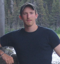
Ryan Powers was born in Sechelt, BC, the small picturesque town tucked between the waters of Georgia Strait and the Sechelt Inlet. He was raised for most of his childhood on Vancouver Island, but returned to his birth place for his high school years. As a youth, he spent much of his time exploring the hundreds of kilometres of beautiful coastlines and the many mountains and old growth forests in the region. Ryan continues to enjoy the outdoors and has recently and enthusiastically taken up sailing.
Ryan received his BSc in Geography from the University of Victoria in 2006. During his BSc, Ryan specialized in Remote Sensing, Spatial Statistics, GIS, and wetland classification. Building upon his B.Sc work, Ryan completed his MSc from the University of Calgary in 2009, where his research involved employing a Geographic Object-Based Image Analysis (GEOBIA) approach to estimate the differences in detected wetlands when high-resolution imagery (<5m) and medium-resolution (>10m) imagery are used. As a PhD student at UBC, Ryan’s research focus is on the application of Remote Sensing imagery to biodiversity assessment and reserve selection across Canada’s Boreal Forests.
Sam Coggins
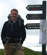 Sam is an MI-6 agent with Double-0 status who performs black-ops missions for the UK government. Sam has sworn an oath of secrecy to protect the nation, so don’t ask who killed JFK or whether the moon landing was faked. Of course he could tell you, but then he’d have to kill you, cover up the crime and relocate to another country.
Unfortunately Sam’s cover has yet again become compromised, forcing another relocation, this time to small town British Columbia, where the authorities have even less chance of catching up with him. Here Sam will continue to practice forestry, GIS, and remote sensing, while accepting missions that enable plenty of back country travel, skiing, and snowboarding.
Steve Gillanders
 Steve belongs to that rare breed of people who were actually born in Vancouver, BC and still reside there. He grew up skiing and windsurfing until he discovered climbing, at which time his life took a drastic turn into the dark world of big wall obsession. Steve worked in the forests of BC as a treeplanter, salvage logger, and woodlot manager and travelled as far as Asia where he spent two years. Upon returning from India Steve studied environmental science at Camosun College and Royal Roads University in Victoria, BC and eventually started a small environmental consulting firm. After several years in the world of small business, Steve decided to return to academia so he came to UBC to do a Masters degree exploring spatio-temporal patterns of mountain pine beetle infestation in the BC interior.
Todd Schroeder
 In 1989 Todd began his academic career studying the behavior of inebriated lab rats in the Department of Psychology at Hanover College. This unique academic experience left him working several uninspiring jobs including stints as a carpet-roller, condominium trader, yellow-page salesman and tennis teaching professional. Todd decided that going back to school might afford a more lucrative career path. While preparing for entrance into a master’s program in geology, Todd fell under the spell of the siren known as remote sensing. Love struck, Todd immediately changed career paths, and in 2002 he completed a master’s degree in Biogeography and Remote Sensing from Indiana State University.
Following the completion of his master’s degree Todd worked as a Remote Sensing Specialist for the Canaan Valley Institute located in Thomas, West Virginia. Still unfulfilled, or simply a glutton for punishment Todd decided school once again sounded fun. So Todd loaded up the truck and headed out west and in 2006 he completed a PhD in Forest Ecology from Oregon State University.
Now fully qualified as a psyhcogeoforester Todd landed a position as a post-doctoral fellow in the IRSS lab at the University of British Columbia. His research interests include integration of field inventory and satellite remote sensing data, characterization of forest disturbance and recovery dynamics with multi-image trajectories, tree species habitat modeling, and mapping forest productivity and site index of Pacific Northwest forests.
In his free time Todd enjoys hiking and camping, landscape photography, listening to reggae music and rooting for the world champion Indianapolis Colts.
Trevor Jones
Trevor Gareth Jones originates from the town of Kirkland in central New York State (NYS). After a youth spent primarily in NYS with two year-long stints in the UK, Trevor attended Clark University (CU) in Worcester, Massachusetts where from he received BAs in Geography and Studio Art (2005) and a MA in GIS (2006). Following CU, Trevor first came to Vancouver in 2006 as one of the original members of the IRSS. After completing his PhD in May, 2011, Trevor moved to Madagascar to work for the conservation NGO Blue Ventures. While in Madagascar, he helped establish the Blue Forests Project. In September, 2013, Trevor returned to the IRSS where from he remotely managed blue forests science and oversaw all things geospatial for Blue Ventures. In September, 2014, Trevor returned to the US, based at Portland State University as an Affiliate Faculty member in the Dynamic Ecosystems and Landscapes Lab in the Department of Environmental Science and Management. At PSU he taught Old Growth Forest Ecology and Management and transitioned into an advisory role with Blue Ventures. In April, 2016, Trevor once again returned to Vancouver, and is currently a lecturer in and coordinator of the Master of Geomatics for Environmental Management (MGEM) program. He continues advising Blue Ventures on blue forests and geospatial science.
Wiebe Nijland
 Wiebe Nijland was born and raised in The Netherlands and studied physical geography at Utrecht University, specializing in remote sensing and land degradation. For his MSc. he spent a few months of 2006 in Prince George, BC working on an internship with the Forest Service on the relation between pine-beetle and landslide hazards. During this time he got hooked on the great Canadian landscape and forests leading him later to UBC. Wiebe received his PhD in Utrecht on Mediterranean evergreen vegetation dynamics, in which he combined remote sensing, geophysical soil measurements, tree-ring analysis, and productivity modelling, with lots of field data collection in sunny France. After the PhD research, he stayed in Utrecht for one year on a teaching position, participating in courses on remote sensing, natural hazards, GIS, and an undergraduate field course in the French Alps. Wiebe defended his PhD thesis in 2011, after which he moved to Vancouver to work as a postdoc at UBC.
Wiebe is an enthusiastic photographer in visible wavelengths and beyond, for which he himself converts cameras. He also likes to ride his bike and enjoys the outdoors both above water and under, taking advantage of any opportunity to scubadive and obtain fascinating subsurface photographs.
Vanessa Mascorro
 Vanessa was born in the beautiful city of Guadalajara, one of the main cities in Mexico. At the age of seven, she moved to a small town where she discovered her passion for nature and outdoor activities. After high school, she returned to the city to complete her bachelor degree in Information Systems at the University of Guadalajara. In 2006, she joined the National Forestry Commission of Mexico, where for six years she led the National Forests Inventory Database. Her newfound interests in forests and forestry motivated her to join the IRSS to start an MSc. Her current research is part of a larger project titled “Integrated modeling and assessment of North American forest carbon dynamics and climate change mitigation options”, carried out by the forest services of Canada, Mexico and USA, and their partner organizations to support policy and decision making regarding climate change. Within this scope, she is focused on the integration of remote sensing data, forest inventories and ancillary datasets to develop comprehensive methods for multi-scale assessment of forest disturbances in Mexican ecosystems for carbon budget modeling.
Thomas Hilker
Thomas obtained a Bachelor of Science degree in forestry from the University of Applied Sciences Goettingen (2000), a Master in Photogrammetry and Geoinformatics from the University of Applied Sciences Stuttgart (2002) and a PhD from the University of British Columbia (UBC) in Forestry (2008). After a 3 year postdoctoral position at UBC (2008-2011), he worked as a Research Associate at NASA’s Goddard Space Flight Center (2011- 2012). From 2012 through 2016 Thomas held a position as Assistant Professor at Oregon State University’s College of Forestry, leading the Remote Sensing Laboratory and teaching classes in remote sensing and spatial data analysis. In 2015 and 2016 he also was a visiting Researcher at the National Institute for Space Studies in Brazil (Instituto Nacional de Pesquisas Espaciais INPE). He looked forward to start a new position as an Associate Professor of Earth System Science and Remote Sensing at the University of Southampton, UK.
Thomas was a well-loved colleague of many remote sensing researchers world-wide. He built a network of collaborators in Canada, the US, Brazil, Europe and Australia. He approached environmental questions and challenges with vigor and zeal and had an enormous curiosity and passion for science. He was respectful of others opinions, eager to share ideas and approaches, and recognized science was a collaborative endeavor. He frequently returned to Vancouver to see old friends, and make new ones, and remained actively involved in UBC research projects enthusiastically supporting and mentoring old and new IRSS lab mates.
Beyond all, Thomas became a good friend to many. His infectious smile, energy and loyalty and sense of humor will be greatly missed.
Piotr Tompalski
 Piotr was born and raised in Poland and studied forestry at the University of Agriculture in Krakow. He spent 6 months on exchange at Wageningen University in the Netherlands where he became very interested in GIS and remote sensing, then deciding to write a master’s thesis at UAKrakow concerning applications of terrestrial laser scanning in forestry.
After obtaining his M.Sc. in forestry in 2008, Piotr began his PhD studies, expanding his research on the applications of various geotechnologies for forestry and nature conservation with a focus on vegetation growth in greatly disturbed areas. His research employs both airborne and terrestrial laser scanning data in addition to satellite imagery. He often uses OBIA tools to process his data, skills he acquired during his internship at Trimble Geospatial Division in Munich, Germany (2010). His research methods were influenced not only by the scientists at his home university but also by the researchers at Vienna University of Technology, where he spent a short time as a visiting PhD candidate.
Aside from his scientific work, Piotr enjoys teaching and loves photography and travelling; he often listens to jazz or progressive rock.
Agatha Czekajlo
 Agatha Czekajlo was born and raised in the rain on the west coast in Metro Vancouver, BC. She completed her BSc at UBC in Environmental Sciences, with a concentration in ecology and conservation, as well as a minor in Philosophy. She had several internship experiences during her BSc, such as working in an environmental chemistry lab, doing forage research at Agriculture and Agri-Food Canada, as well as doing policy and regulation work for Canadian Natural Resources Ltd. After working in the IRSS as a Work Learn student during her senior year, she decided to stay a bit longer and pursue her Masters. Her project considers characterizing land use and green space in Canadian peri-urban areas over the last three decades using mostly Landsat satellite imagery. Agatha enjoys travelling, hiking, mushroom foraging, and good coffee!
Bryn Gerson
 Born and raised in the state of Oregon, Bryn moved to Vancouver for school and is in the 5th and final year of a BSc. in Forest Sciences with a focus in ecology and society. Bryn worked as an undergraduate Worklearn student in the lab, with interests in the ability of remote sensing data to show landscape level disturbances over time and inform sustainable management and conservation decisions. When neither working nor learning Bryn enjoys backpacking, road biking, mushroom foraging, and reading graphic novels.
Daisy Zhao
 Daisy was born in Suzhou, China and immigrated to Canada when she was 2 years old. Her childhood in Toronto and later in the Rockies when she moved to Calgary, exposed her to both the urban and natural parts of Canada. Upon moving to Vancouver for her Bachelor of Science degree in Biology at UBC, she was inspired by the city’s integration of social and ecological values, and environmental research. After taking a remote sensing course with Dr. Paul Pickell, Daisy was astounded by the myriad of questions that remote sensing had the power to answer and joined the IRSS Lab as a WorkLearn. Enjoying her work in the lab, Daisy then joined on to pursue a Masters degree. Her work is focused on the detection, mapping, and attribution of mountain roads in forested Caribou habitat in northern BC. In her free time, Daisy enjoys playing basketball, cooking, watching TV, and going on spontaneous adventures.