Eliceo Ruiz Guzman
Born in Minneapolis, Minnesota, and raised in Guadalajara, Mexico, Eliceo earned his Bachelor’s degree in Agricultural Engineering at the University of Guadalajara. Before moving to Vancouver, he worked with the National Institute of Forestry, Agricultural and Livestock Research (INIFAP), studying how wildfires affect the natural regeneration of pine in the forests of Jalisco. He completed his Master’s degree in Environmental Observation and Informatics at the University of Wisconsin–Madison. During his Master’s, he worked with hyperspectral imagery and machine learning models at EnSpec (Environmental Spectroscopy Laboratory) and ASCEND (Advancing Spectral biology in Changing Environments to understand Diversity) to map tree species distribution in the Chequamegon-Nicolet National Forest in Wisconsin. He is now joining IRSS to pursue his PhD, using remote sensing to assess wildfire fuel availability across different ecoregions along the Pacific North West of Canada and the United States at the WIRED Global Center project.
Outside of work, Eliceo enjoys playing drums, hiking, and capturing photos of wildlife and landscapes.
Hiroto Goto
 Hiroto was born in Japan but spent his childhood in New York. He completed his undergraduate degree in Agriculture at Kyushu University, where he focused on forest management using remote sensing. Driven by a long-standing passion for wildlife and nature, he gained experience with wildlife monitoring and explored how satellite data products can be used to estimate mammal distributions across Japan. Following graduation, he broadened his experience in remote sensing applications at the University of Tokyo before joining the IRSS lab. Hiroto is currently a Master’s student, where his research focuses on surveying moose populations in Canada using drones and deep learning.
Outside of the lab, he enjoys playing the piano, often jamming to random songs with friends. He also likes exploring the Canadian wilderness through outdoor activities.
Madison Brown
Madison Brown grew up in Perth, Australia, and Bologna, Italy, but spent most of her childhood in Bend, OR, USA. She moved to Vancouver in 2017; completing a Bsc. in Plant and Soil Sciences with a minor in Geological Science (2021). She initial became intrigued by the numerous applications of remote sensing while undertaking a directed studies project looking at detecting glacial retreats impact on agricultural resources using Landsat imagery. After graduating she worked as Geologist/GIS Manager in Northern BC before returning to UBC.
Her MSc. research focuses on focuses on detecting and assessing the impact of non-stand replacing disturbance (mostly insects) utilizing both Landsat/Sentinel-2 times series and LiDAR. Outside of her research she enjoys skiing, drinking coffee, cycling, trail running, podcast walks and craft projects.
Liam Irwin
Kirk Johnson
 Kirk is a PhD student exploring risks that are likely to impact forest landscapes using forest estate planning tools, climate-informed models, and remote sensing data. His work will also consider spatially-explicit management strategies and adaptive silvicultural treatments, assessing their cumulative impact on forest growth. Growing up in the forest country of Northern Idaho, Kirk completed his BSc in Forest Resources at the University of Idaho and moved north, pursuing an MSc in Forest Biology and Management at the University of Alberta. There, he focused on reforestation silviculture and modeling growth in juvenile white spruce plantations. After his MSc, Kirk worked at the University of Alberta and became an associate developer of the Mixedwood Growth Model (MGM), a tree-level growth model for mixed-species stands in the western Canadian boreal forest. While working with MGM, Kirk incorporated climate-sensitive functions into the model, created new modules for site index and self-thinning, and explored climate effects on stand yields. He also supported a comprehensive review of MGM for forest management planning in Alberta.
Outside of work, Kirk enjoys hiking, skiing, and exploring the landscapes of western Canada.
James Maltman
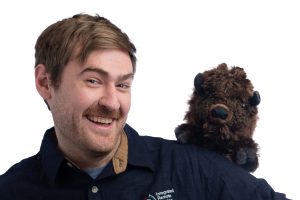 James grew up in and around Seattle, Washington. He completed a Bachelor’s degree at the University of Washington in Political Science, focusing on Environmental Politics. Deciding he wanted to pursue environmental science more, he gained a Masters in Environmental Protection and Management from the University of Edinburgh, with his dissertation examining the use of photogrammetry to evaluate the impact of rock climbing on cliffside biodiversity.
After spending a year out of academia working as a sustainability consultant, he joined the lab in 2021, with his current research attempting to predict forest age Canada wide using landscape level satellite data.
Outside of work, he is an avid skier, climber, and hiker, who enjoys a good book as much as a big day in the mountains.
Ramon Melser
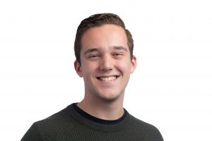 Ramon was born and raised in the Netherlands, but moved to the Vancouver area in 2012. He graduated with a BA in Environment & Sustainability from the UBC Geography department in 2019, which is where he was first introduced to applications of remote sensing and GIS for environmental issues and conservation. Eager to grow his geomatics skillset, he returned to UBC after a year of travelling and went on to complete the Faculty of Forestry’s MGEM program in 2021. The MGEM experience led him to join the IRSS, where he is a research scientist working on enhanced carbon dynamics and land cover change assessment using integrated satellite-derived datasets and analysis approaches.
In his free time, Ramon is an avid foodie, explorer of the great outdoors, and enjoys going to concerts.
Evan Muise
Evan Muise was born and raised in Halifax, Nova Scotia, obtaining his undergrad degree in environmental sciences with a GIS certificate. Evan is working towards his PhD in the IRSS using forest structure and productivity metrics to examine ecological integrity across the forested ecosystems of British Columbia.
Outside of work, Evan spends his time with his dog, Shadow, cooking food for his friends (or just himself), and enjoying the variety of beers found in British Columbia.
Brent Murray
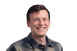 Brent Murray is from Winnipeg, Manitoba, where he completed his Bachelor of Arts (Honours) in Geography with a focus in geomatics. He expanded his knowledge and skillset for remote sensing through the Master or Geomatics for Environmental Management (MGEM) program at UBC. After his time in MGEM, he worked as a GIS Specialist in Kelowna, BC, specializing in remote sensing. Brent is now a PhD student in the IRSS lab, focusing on tree species and wood quality prediction using multisource remote sensing data and deep learning algorithms.
Brent enjoys spending time with friends over good food and beer. He also loves spending time hiking, canoeing, and camping.
Lukas Olson
Lukas is originally from Vancouver, BC, and grew up sailing, hiking, and camping throughout the Gulf Islands. This deep connection to the BC landscape naturally led him to forestry. Building on his undergraduate studies in Urban Forestry from the University of British Columbia (2023), Lukas joined the IRSS to pursue graduate research. His current interests explore assessing the novel application of remote sensing technologies within the forest canopy, such as LiDAR and photogrammetry systems, sensor networks, and drones, to quantitate conventional visual health attributes in Northern Hardwood species.
When not immersed in his studies, Lukas enjoys spending time camping, programming, and exploring new hobbies.
Harry Seely
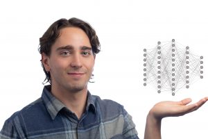 Harry grew up in Surrey, BC and has loved the great outdoors since he was young. Harry completed his undergraduate degree in Biology at the university of Guelph, specializing in Wildlife conservation. After developing a passion for GIS, cartography, and remote sensing, he decided to further pursue these skills as a career. In 2022, Harry completed the Master of Geomatics for Environmental Management (MGEM) program at UBC and began a doctoral thesis in the IRSS.
Harry’s research applies deep neural networks (DNNs) to estimate aboveground biomass in forests across Canada. This work brings together several different datasets, including provincial forest inventory, airborne LiDAR, and multispectral satellite imagery. A major focus in this research is transferring effective artificial intelligence methods to forest applications, including data fusion, self-supervised learning, and deep ensembles.
When he’s not spinning point clouds and tweaking DNNs in the lab, Harry enjoys bikepacking, swimming and playing beer league soccer.
Spencer Shields
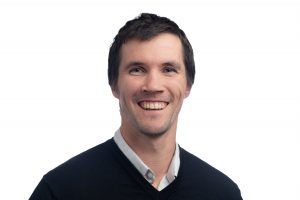 Spencer is a master’s student whose research focuses on using constellations of micro-satellites to help characterize the nature and severity of forest disturbances. Prior to pursuing graduate studies, he also completed a Bachelor’s of Science in Natural Resource Conservation at UBC. His interest in ecology, conservation, and resource management is rooted in his own love of the outdoors and his background working in adventure tourism: from 2014 to 2019, he led wilderness trips in New Zealand, Belize, Costa Rica, Panama, and his native British Columbia. This experience working in diverse ecosystems, with clients and co-workers from a variety of backgrounds, continues to shape his approach to environmental science and education. As a member of the IRSS, he is excited to be developing tools to help facilitate landscape-scale decision making.
When he’s not in the lab, he can usually be found climbing, sea kayaking, or seeking out new brewery patios.
Sarah Smith-Tripp
sarahsmith.tripp@alumni.ubc.ca
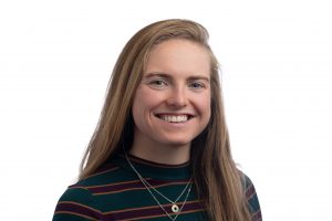 Sarah is a proud Oregonian-British Columbia transplant. She spent her undergrad studying geosciences on the east coast at Wellesley College near Boston. Her research passions have taken her all around the world – Lake Baikal in Russia, Mongolia, and even two months sailing a tall ship across the South Pacific. Upon graduating undergrad, she couldn’t wait to move back west to complete an MSc in Geography at UBC (May 2021). Her research allows her to do one of her favorite things – tromp around burned forests.
Some of her other pass times include running, backpacking, and cycling. Sarah is an incoming PhD student modeling forest regeneration following the wide-spread and severe BC wildfires in 2017-18. To do so, she uses a combination of satellite data (landsat, MODIS) and high-resolution Lidar and drone data. She remains inspired by the great outdoors and wishes to help preserve what has made her life so wonderful for many generations to come.
Leanna Stackhouse
 Leanna is a PhD candidate whose research is in the intersection of fisheries, forestry, and applications of remote sensing. Her thesis focuses on characterizing riparian vegetation structure and its impact on salmon-bearing watersheds on Vancouver Island, Canada, using airborne and drone laser scanning. Prior to starting at UBC, Leanna obtained her bachelor’s degree in geological sciences and a graduate certificate in geographic information systems from the University of Delaware. Her first hands-on experience in research was assisting with paleontological digs in Montana, USA, where she was infamous for never finding a single bone (but helping excavate plenty others).
Outside of work, Leanna loves baking, the product of which you can usually find in the IRSS on lab meeting days.
Hana Travers-Smith
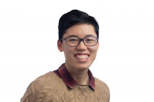 Hana is a PhD student who joined the IRSS in 2022. Their research investigates changes in vegetation productivity and structure along Canada’s northern treeline driven by a warming climate.
Hana grew up in Victoria, British Columbia and completed their Bachelor’s and Master’s degree at the University of Victoria. Their Master’s research used remote sensing tools to explore how permafrost thaw and climate change have impacted lakes and ponds across the Northwest Territories and Yukon. They hope to one day to return to the Arctic and experience the northern lights!
Outside of the lab Hana enjoys playing soccer and ultimate frisbee and taking cute photos of their cat, Henry.
Tommaso Trotto
Tommaso was born in the countryside near Venice, Italy, where he once dreamed of becoming a forester in the Alps. At the same time, he had always aspired to move abroad and explore the wild and remote forests of Canada. Not long after, he made it to Vancouver and completed a double-degree Master’s program in Forestry (TRANSFOR-M) between the University of Padova, Italy, and UBC. During that time, Tommaso was deeply impressed by the versatility, technical depth, and integration of remote sensing into forestry — an interest that has continued to shape his work during his PhD at UBC. Since 2022, he has been a PhD Candidate at IRSS, where he is exploring how lidar and Landsat can detect and map fine temporal changes in forest structure to help make forests more resilient to spruce budworm infestations.
When he’s not in the lab, you can find him biking, climbing, enjoying the beach, or sharing a good Italian meal with friends.
Brianne Boufford
 Brianne, originally from Surrey, British Columbia, graduated from UBC in 2022 with a BSc in Physics. Brianne experimented with a few different areas of data science before learning about remote sensing when she joined the IRSS as a work learn student. After graduating, she spent a year working as a remote sensing analyst before returning to do her MSc. Brianne’s project uses LiDAR and satellite imagery to improve how forest recovery after disturbance is simulated in Raven, a process-based hydrological model.
Outside of work, Brianne loves to run, hike, camp, and ski. When it’s too wet to do any of those, you can likely find Brianne poking around a local thrift store or finding somewhere to get a coffee.
Cody Lai
 Cody grew up in North Vancouver, BC, where he completed a Bachelor’s degree in Urban Forestry. During his undergraduate studies, he undertook a work placement in Taiwan as a research assistant, focusing on analyzing the effects of climate change on local vegetation using historical Landsat data. This experience introduced him to programming and remote sensing, sparking his interest in geomatics and leading him to apply for the Master of Geomatics for Environmental Management (MGEM) program at UBC. After completing the MGEM program, Cody spent a year in Kelowna as a forestry analyst before transitioning to the Department of Fisheries and Oceans (DFO) as a GIS Analyst for three years. In this role, he helped establish multiple Marine Refuges in the Northern Shelf Bioregion, focusing on fishery overlap analysis and establishing spatial geographic closure descriptions.
Cody is now a PhD student in the IRSS lab, where he focuses on linking BC’s extensive LiDAR datasets to forest growth and yield models. When not in the lab, Cody enjoys skiing, climbing, and surfing.
Sadie Russell
 Sadie is a PhD student from Vancouver, British Columbia. Always drawn to
the coast, she moved to Halifax, Nova Scotia, to complete a Bachelor of
Science in Environmental Science at Dalhousie University. She later
returned to Vancouver to pursue a Master of Geomatics for Environmental
Management at the University of British Columbia. During her master’s, she focused on using remote sensing to explore the connections between forest health and wildfire risk. Her current research focuses on using lidar to evaluate pyrosilviculture treatments that support fuel management and
enhance the use of forest residuals.
In her free time, Sadie enjoys exploring new foods, crafting, and spending
time on the water, whether she’s paddling, swimming, or simply soaking in
the view.


