Landscape pattern analysis of mountain pine beetle infestation using a multi-date image time series
Steve Gillanders (MSc completed)
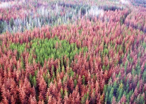
 The current epidemic of mountain pine beetle (Dendroctonus ponderosae Hopkins) in British Columbia presents a considerable challenge to forest resource managers. As a result of anthropogenic and climatic influences on the lodgepole pine ecosystem, mountain pine beetle populations in the central interior of British Columbia have reached epidemic proportions leading to tree mortality at a regional scale.
While several management options exist to minimize the impacts of mountain pine beetle, knowledge of the spatial and temporal patterns of infestation at the landscape level has the potential to contribute to the effectiveness of these techniques and lead to new management options. Furthermore, this information is critical to predict the effects of landscape changes on both biodiversity and ecosystem functioning and services.
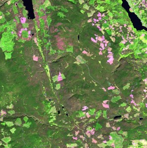
Mountain pine beetle-induced tree mortality and operational logging (including related salvage and mitigation activities) lead to habitat fragmentation at both a landscape and local scale. This has important ecological implications related to habitat abundance, biodiversity, and the influence that changes in spatial pattern have on a variety of ecological processes. Using a time-series of nine Landsat images spanning a period of 15 years positioned in the central interior of British Columbia, landscape pattern indices will be used to identify and measure changes in the degree of landscape fragmentation and connectivity associated with both beetle infestation and logging.
 The information gained from these analyses will provide the means to characterize forest conditions prior, during, and subsequent to mountain pine beetle infestation and will contribute to a better understanding of mountain pine beetle outbreaks, forest stand mortality, and landscape disturbance and recovery.